Artificial Intelligence
GeoVodcast #1: Spatial Inequalities in Deprived Urban Areas
34:21
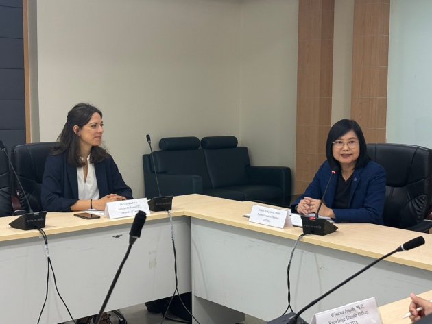
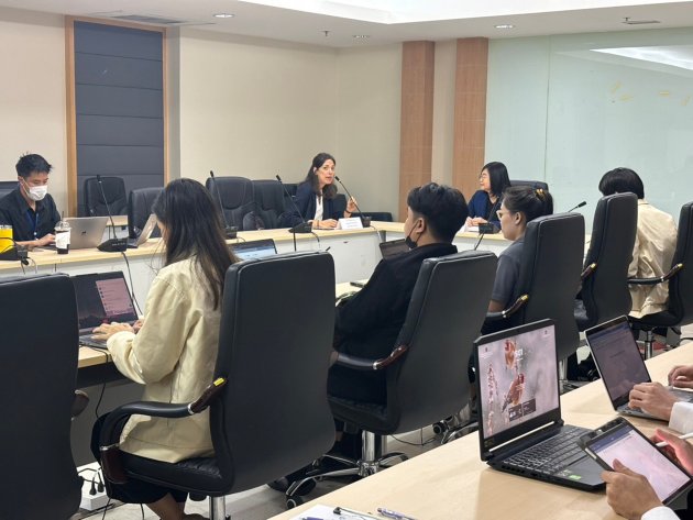
I had the pleasure of being invited to the Geo-Informatics and Space Technology Development Agency (GISTDA) in Bangkok to deliver a Tailor-Made Training (TMT) program: a truly rewarding and enriching training experience.
This training focused on the application of Artificial Intelligence (AI) techniques for crop type mapping, leveraging the rich temporal information provided by Satellite Image Time Series (SITS) acquired by the optical multispectral Sentinel-2 data and Synthetic Aperture Radar (SAR) Sentinel-1.
Although AI-based solutions for SITS are powerful, the development of a successful workflow requires a deep understanding of the unique characteristics of the study area.
To address this, the training was co-developed with the trainees, integrating AI methodologies with their expertise on crop calendars (e.g., planting and harvesting periods), farming practices, dominant crops, and the influence of weather conditions. This collaborative approach significantly enhanced the accuracy and relevance of the results.
Crop type mapping is essential for understanding and managing agricultural landscapes. Accurately identifying the distribution and extent of different crops enables efficient resource allocation and farming practices (e.g., optimizing irrigation, fertilization).
Crop type mapping is crucial for assessing crop production, estimating yields, and monitoring food security. Currently, agriculture is highly affected by extreme weather events, such as droughts, hail, and storms, which pose a significant threat to agricultural productivity and sustainability. Accurate and up-to-date maps of crop locations are required to mitigate the effects of these extreme weather phenomena.
Satellite data have been widely used for mapping crop types, offering the possibility of generating high-resolution maps of crop types on a seasonal and annual basis globally. The combined use of AI and satellite data enables the mapping of crop types on a large scale and has the potential to provide continuously updated maps of crop types.
For example, the recent ESA Worldcereal initiative is now able to generate maps depicting the locations of major cereal crops at the global level every six months.
The intensive one-week course was structured into four key phases:(1) SITS data collection and preparation; (2) SITS analysis and feature extraction, (3) develop AI-based crop type mapping solution, and (4) reflection and analysis of the results obtained. The workflow was designed and tested within GISTDA's area of interest, a cropland region in Thailand's Loei Province.
The course was designed to build long-term capacity within GISTDA, a key institution in Thailand’s geo-informatics and space technology sector. The training focused on equipping participants with essential skills to develop AI-based workflows, enhancing their ability to use satellite data to perform crop type mapping.
The automated workflow was specifically developed to handle multimodal satellite data, taking advantage of the freely accessible time series of satellite data provided by the European Space Agency (ESA) through its Copernicus Programme, i.e., Sentinel-1 and Sentinel-2 data.
During the course, the complementary information provided by Synthetic Aperture Radar (SAR) Sentinel-1 and multispectral Sentinel-2 images were used to produce accurate crop type mapping results.
In the video below, we can see the 2023 annual Sentinel-2 composite in true color (bands 4, 3, and 2), a false-color composition of the same image (bands 12, 11, and 4), and the 2023 annual Sentinel-1 composite, highlighting VV and VH polarizations.
One of the highlights of the training was the hands-on implementation of the workflow using Google Earth Engine (GEE), a robust cloud-based platform for satellite image analysis. Theoretical lectures alternated with practical training sessions and co-developed hands-on activities, allowing participants to connect conceptual knowledge with real-world applications and challenges effectively.
The secret to the success of this training lay in the collaborative approach we adopted. We co-designed the research solution by combining the local agricultural expertise of GISTDA researchers with state-of-the-art AI technologies. This integration of local knowledge and foundational skills in AI ensured that the training was not only theoretically relevant but also directly applicable to mapping and monitoring crop types in Thailand.


While ML-based solutions applied to satellite time series of images can be highly effective, accurately mapping crop types requires considering the specific characteristics of the study area. Integrating ML approaches with local knowledge—such as crop calendars (e.g., planting and harvesting periods), farming practices, dominant crops, and the impact of weather conditions—significantly enhances the potential for achieving more accurate and meaningful results.
By gaining a deep understanding of the region's agricultural patterns, crop calendar, and farming practices, we were able to tailor the AI models and methodologies to support actionable insights. The co-development approach extended beyond the technical aspects.
Throughout the week, participants had multiple opportunities for knowledge exchange, discussions, and feedback sessions. This interactive environment facilitated a deeper understanding and cultivated a shared commitment to designing effective AI-based workflows, boosting the confidence and enthusiasm of the GISTDA researchers.
Looking ahead, I am excited about the potential impacts of this training initiative. Hopefully, the success of this collaborative approach will open future capacity-building collaboration, highlighting the importance of combining local expertise with advanced technologies to address complex challenges.
As a trainer, this experience has been immensely rewarding. I look forward to seeing the positive outcomes from this initiative and continuing to support similar efforts in the future.
Interested to learn more about crop type mapping? Check out some of my publications:
AI4SmallFarms: A Data Set for Crop Field Delineation in Southeast Asian Smallholder Farms