Natural Resources Management
How a geo-information app helps vegetable farmers to optimise inputs and boost productivity
6 min


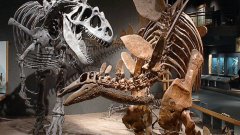
Dinosaurs are undoubtedly the most famous of all extinct creatures that have lived on our planet – a fame only matched by their popularity.
However, identifying these iconic animals and reconstructing their environment is an intricate puzzle.
First, we do not know how many pieces the fossil set is made of, and second, the pieces are scattered throughout different sites.
The first step in assembling (a part of) this puzzle is to determine what in natural history is designated by the specimen: physical evidence attesting to the presence of a given species at a particular timeframe and location. In the case of palaeontology – the science that studies extinct life forms – a specimen is usually fossils belonging to one single organism.
It's important to clarify that a specimen is not a species: species (lifeforms) are identified and described based on specimens; therefore, determining what constitutes a specimen is paramount to building the catalogue of lifeforms on Earth.
Sometimes, determining what fossils constitute a specimen can be problematic, especially when the fossils to be incorporated into a natural history collection have an incomplete lineage. In other words, they were extracted without proper excavation techniques and registration – that is, when excavating also keep a record of the geology, stratigraphy, soil type and extraction strategy. As a consequence, the fossil assemblages might be mixed up because more than one specimen might have been extracted from a single fossil site.
Another issue is that these incorporations usually lack information about exactly where the fossils were retrieved. These issues are common with fossil donations or collections gathered by enthusiasts.
The Natural History Society of Torres Vedras from Portugal is a not-for-profit organization that manages the most extensive repository of fossils from the Upper Jurassic (circa 163.5 to 145 million years ago). Much of this repository consists of a private collection gathered thanks to the enthusiasm and dedication of Mr José Joaquim dos Santos, who, over more than 20 years, prospected and collected (mainly) dinosaur fossils throughout 80km of the Portuguese West coast ranging from Nazaré, in the North, to Mafra in the South.
However, the thousands of fossils gathered suffer from the above-mentioned registration issues. The challenge was, therefore, to build a first inventory to determine what assemblages constitute a specimen and, from there, proceed to species identification.
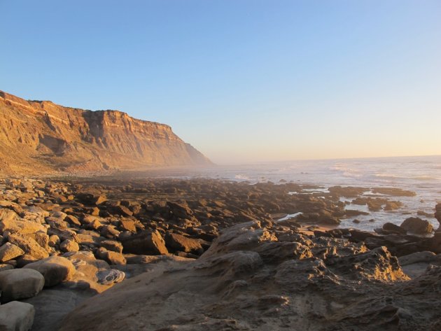
The Portuguese west coast, near Assenta.
Before transferring the fossils from the original storage facilities to the ones managed by SHN, a first inventory had to be in place to prevent the mixing of fossil assemblages. It was then decided to build a first inventory based on the location from where the fossils were retrieved – identifying specimens would take many years, but preserving sets according to the location from where they were retrieved would be a much faster approach, with the advantage that the classical specimen-based inventory of the collection could be taken up later, once the collection was deposited in the new storage facilities.
Luckily, this approach was possible because Mr. dos Santos kept field notes and had an excellent memory. Because of this, it was possible to visit most of the sites from where the fossils were retrieved under the guidance of Mr. dos Santos – more than 250 fossil locations were surveyed with handheld GNSS (Global Navigation Satellite System) receivers over three months of fieldwork back in 2010.
In addition to information about the fossils themselves, the fieldwork was also used to register observable features about the location from where the fossils were collected. Examples of such information include the (apparent) anatomical part (a femur, a vertebra, etc), the animal group (theropod, sauropod, crocodile, other), the geological context, the administrative area and others.
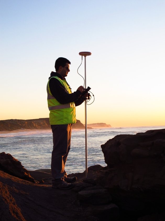
GNSS Survey at Porto Novo.
The surveying work allowed us to build an association between a location and fossils – regardless of how many specimens were retrieved from that location. Each location was assigned a unique identifier, which played a crucial role in building the first systematic inventory of the collection by providing pivotal information upon which the collection transfer to a more suitable installation was based.
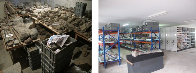
The original (left) and the new (right) storage facilities.
Once the bulk of the collection was transferred to the new facilities back in 2013, the work of specimen identification and preparation began and continues to this day with the help of palaeontologists from Portugal, Spain, Germany, Turkey, Netherlands, and Poland. This effort adds new pieces to the puzzle of the history of life on Earth; so far, 38 species of animals – not only dinosaurs – have been identified, of which 6 constitute new species previously unknown to science.
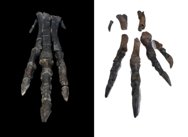
Left: posterior foot of an Eoudryosaurus. Right: posterior paw of a Lusovenator.
It turns out that location is a critical variable in understanding the fossil and how it relates to the topography, geology, zoning plans, and administrative units. That is often an overlooked aspect of geographical data: locating something is not just about knowing where it is - it is also about understanding how it relates to other features of our world. That is the power of geolocation.
The locations of the fossil sites surveyed with GNSS receivers were uploaded to a spatial database containing many other datasets: geology, satellite imagery, administrative areas and topographic elements. All these were then made available to the palaeontologists via a webmap application that allows the exploration of fossil sites from a landscape point of view.
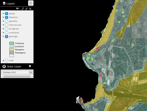
The webmap interface.
Having geolocation data stored consistently and reliably was instrumental in having the zones of paleontological interest included in the most recent revision (2023) of the zoning plan of the Municipality of Torres Vedras - where the bulk of the recorded fossil sites are. This inclusion enables restrictions on human activities that require excavation or other types of soil movements.
In practice, this means that when such activities are to be carried out in areas of paleontological interest, they might require prevention measures such as prior surveys or supervision of the works by a palaeontologist to minimize the chances that new fossils are destroyed or discarded entirely.
Geolocation has enabled the known fossils to continue to be prepared and studied by palaeontologists. Meanwhile, the fossil record that is yet to be unearthed is also being protected by local spatial planners, which is an essential precedent for protecting a few of the pages of the book, The History of Life on Earth.
To know more about this case, check out the following article called Location-Based Management of Paleontological Collections using Open Source GIS Software
Header picture: Luke Jones from Yucca Valley, CC BY 2.0, via Wikimedia Commons