Food Security
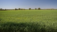
Is this the farm of tomorrow?
5 min
Tropical rainforests play a key role in regulating the Earth's climate, and a big part of this is through evapotranspiration (ET), which is how water moves from the ground through plants and back into the air.
Measuring ET can be challenging because most methods - such as eddy covariance or sap flux - are expensive or require a lot of work. These methods also usually don’t represent the spatial patterns of ET.
Using remote sensing technology, such as satellite images or aerial photos, can make it easier and cheaper to estimate ET. However, these methods often lack the detailed resolution needed to accurately measure differences at the tree level.
In this study, we explored a new method that uses high-resolution thermal images captured by drones (uncrewed aerial vehicles, or UAVs) to estimate ET in tropical rainforests.
Our main question was whether using drone-based thermography (thermal imaging), combined with a simple model, could reliably measure ET in tropical rainforests. We specifically wanted to see how ET changes in different areas and seasons of the rainforest.
By using UAV-based thermography, we hope to create a more accurate and efficient way of measuring ET than traditional methods, especially in areas where gathering data is difficult because of the remote nature of tropical rainforests.
We flew drones during three periods: November 2016 (wet season), July 2017 (early dry season), and September 2017 (late dry season). The research took place in the Harapan rainforest in Sumatra, Indonesia. We focused on two types of sites: dry upland areas and riparian sites (areas near rivers that flood during the wet season).
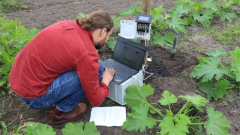
The octocopter UAV used a radiometric thermal camera to collect data, and we also placed environmental sensors on the ground to measure solar radiation for our model.
The mean daily ET in the study area was 3.26 ± 0.73 mm, similar to what has been measured in other tropical rainforests. This underscores the uniformity of ET processes in diverse rainforest ecosystems.
We found a strong positive correlation between our drone-based ET estimates and traditional sap flux measurements, showing that drones can be an effective way to measure ET.
However, the sap flux measurements were lower, which could be due to limitations in the tools used for these traditional methods.
We observed differences in ET between upland and riparian sites, with upland areas having 11% higher ET, likely because of variations in forest structure and local conditions.
Surprisingly, we found no significant difference in ET between seasons, suggesting that water availability wasn’t much of an issue despite seasonal changes.
Using high-resolution data and advanced modeling made our results more reliable.
However, there were some limitations, such as the thermal dissipation probe method for sap flux measurements. Also, the findings might not apply to all tropical rainforests.
This method offers valuable insights that can help with land use planning, conserving biodiversity, and managing resources in tropical rainforests. It is especially useful for monitoring forests in areas with limited data.
We found that drones can accurately estimate ET using canopy temperature and supporting environmental data, although there are some biases when compared to sap flux measurements.
The results showed more variation in ET at drier upland sites compared to wetter riparian sites.
Interestingly, there was little difference in mean ET across seasons, indicating that water availability in the study area might not be as affected by seasonal changes as expected.
This story is adapted from a published journal article: Bulusu, M., Ellsäßer, F., Stiegler, C., Ahongshangbam, J., Marques, I., Hendrayanto, H., ... & Hölscher, D. (2023). UAV-based thermography reveals spatial and temporal variability of evapotranspiration from a tropical rainforest. Frontiers in Forests and Global Change, 6, 1232410. It has been adapted in accordance with the copyright license CC BY 4.0
To read the original article, follow the link below:
Login and start learning!