Remote Sensing
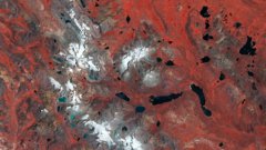
Earth from Space: Pariacaca Mountain Range, Peru
3 min
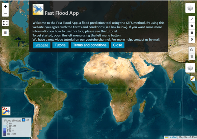
Fastflood.org is a real-time simulation platform that achieves about 97% accuracy in predicting floods while being about 1,500 times as fast. It provides an instant flood forecast for the selected area.
During the development phase, the researchers noticed that many people were very impressed. However, usability was an issue, as the platform was part of a scientific software package. The team then decided to turn their creation into a web-based simulation tool. This means that now everybody can go to the fastflood.org website and use the model.
Users do need a little bit of background knowledge to be able to apply the different settings, get input data where it needs to be and recognize when things are working well and when they are not.
The accessible web-based approach was also aimed at expanding the user base to not only include students and researchers but also professionals such as flood consultants and decisions makers.
The main benefit of fastflood.org is the model’s exceptional speed, which also allows for interactivity. Someone interested in, for example, designing a levy system or placing a reservoir can sketch those objects into their landscape and immediately see the impact on the flood forecasts from the model almost instantly.
A second benefit is that the platform has been linked with global data sets. They include a lot of satellite-based data for the entire Earth, covering features such as the elevation of the landscape, surface cover building types, forests, pastures, and soil types. All this information is very relevant for flood modelling. These global data sets are automatically fed into the model, which saves the users a lot of manual work.
The model’s speed is achieved in part by making approximations, which is normal for any physically-based model. However, making these approximations means that reality can never be perfectly modelled.
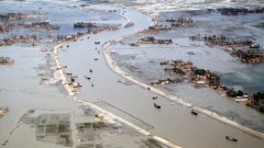
In the case of fastflood.org, some type of flood events can be modelled very accurately, such as flash floods, riverine flooding, or rainfall driven flooding.
The platform in its current state is not suitable for modelling, for example, circular levy systems that fill up with water from the outside.

A screenshot of the Fast Flood app.
How is the application used? Here is a step by step guide:
Users can add their own parameters, such as infiltration of water going into the soil, channel definitions and land cover details.
By sketching a mitigation measure – such as a reservoir – into the generated prediction, users can test the effectiveness of the measure. The flood simulation will then adapt accordingly in real time.
As for future updates to the model, the team is looking to improve the global data sets by pre-processing them.
Another addition being considered is developing better training materials for users.
Finally, the researchers are investigating ways to model other processes as well, such as mass movements and landslides.
Visit this link to view some of the showcases on the Fasflood website
Login and start learning!